Recommendation points
The process of observing the first artificial satellites of the Earth revealed one interesting pattern – the spatial position of the satellite can be calculated with good accuracy at any moment in time. This scientific fact pushed scientists to a truly revolutionary discovery – to use satellites located hundreds of kilometers from the Earth to determine the spatial position of terrestrial objects.
From the previous articles of our series “Applied Geodesy” we learned that to determine the coordinates of an unknown point, we need two points with known coordinates, which are rigidly fixed on the ground (points of the State Geodetic Network). Sometimes they were far from the subject, which forced the performers to lay theodolite passages, often several kilometers. Now, satellites constantly moving in space have become a kind of “hard” points, relative to which the coordinates of objects on the ground are determined.
GPS
GPS (Global Positioning System – Global Positioning System) is a collection of electronic means that calculate the location and speed of an object on the Earth’s surface or in the atmosphere. These parameters are determined thanks to the GPS-receiver, which receives and processes signals from satellites. To improve the accuracy of measurements, the positioning system also includes ground control and data processing centers.
When it comes to GPS, most often we mean the NAVSTAR system, developed by order of the US Department of Defense. In general, a lot of innovative things were first “tested” by the military, and then they were “released to the masses.” For many years the term “GPS” has become synonymous with satellite navigation, just as the neologism “Xerox” means, in principle, any copier, and not just the production of XEROX. At the moment, in addition to NAVSTAR GPS, Chinese Beidou, European Galileo, Indian IRNSS, Japanese QZSS and our native GLONASS are being developed or launched..
Space measurement methods are used for:
- geodesy and cartography
- construction
- navigation
- vehicle monitoring
- mobile communications
- rescue operations
- monitoring the tectonic movement of the earth’s crust plates
and in many other spheres of human activity. Let’s consider some of the main areas of application of space measurement systems in more detail..
GNSS
We come across devices of this navigation system at the household level, under the abbreviation GNSS the term “Global Navigation Satellites System” is hidden. The principle of operation of a satellite navigation system is to measure the distance from the receiver antenna to satellites, the positions of which are known with a sufficiently high accuracy. The satellite position table is called the almanac and is transmitted at the moment of the start of measurements from the satellite to the receiver. Thus, knowing the distances between the satellites, and being guided by the almanac, you can, using the simplest geodetic constructions, which we considered in the previous articles of our cycle, calculate the spatial position of the object.
The method for measuring the distance from a satellite to a receiver is based on determining the speed of transmission of radio waves. To enable measurements, satellites transmit precise time signals, synchronized in turn with high-precision atomic clocks. At the beginning of operation, the system time of the receiver is synchronized with the satellite one, and further measurements are based on the difference between the time of signal emission and the time of its reception. Based on these data, the navigation device calculates the spatial position of the terrestrial antenna, and the object’s speed, course, and other parameters are derivatives of the initial position of the receiver. As you probably remember from your high school physics course, the speed of radio waves is equal to the speed of light, so you can imagine what the overall accuracy of the system that determines the distance in milliseconds is.
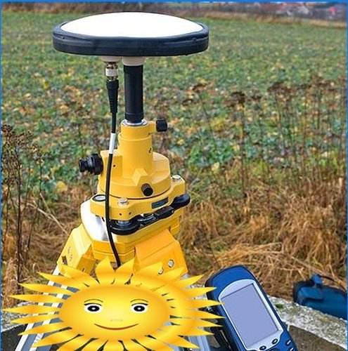
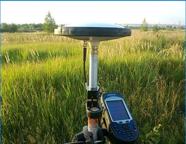
GNSS / GPS antenna
Why, in some cases, we get a sufficiently accurate location value, and in some cases, the value is not entirely correct? Not every receiver has an atomic clock built in, therefore, to synchronize and determine the position with acceptable accuracy, it is necessary to receive a signal simultaneously from at least three satellites. The strength of the received signal is affected by the gravitational field of the earth, obstacles in the form of trees, houses, reflected (phantom) signals, atmospheric interference and a number of other reasons. Since it is impossible to place high-power transmitters on the satellite, you will get the most accurate location in open spaces with a clear horizon.
Now, dear reader, who has a smartphone with a built-in GPS receiver, we hasten to disappoint you – you cannot apply to open a geodetic company. This is because the pocket receiver uses a method called absolute to calculate the position. With the simultaneous observation of 4 satellites, the positioning accuracy can reach 8 meters, which is enough for navigation measurements. For geodesy, a relative measurement method is used, in which at least two receivers are used. One of them is set to a point with known coordinates (the so-called “base”), and the second is used to determine the coordinates of unknown points. When two receivers work together, the measurement accuracy increases 100 times, and we can already get coordinates with centimeter accuracy, which is sufficient for geodetic needs.
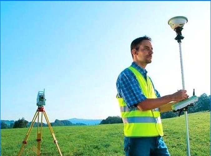
GPS for geodetic works
To use space observation systems for topographic work, several methods are used, which differ in the accuracy of the obtained values and the time spent to obtain them..
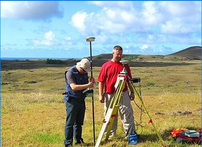
Statics
To determine the coordinates of an unknown point, one receiver is installed on the triangulation or polygonometry point (known point), and the other receiver is placed on the point whose coordinates are to be determined. Further, the devices are synchronously initialized, because measurements begin only when two receivers are turned on simultaneously. If one of the devices worked for half an hour and the other for 15 minutes, only 15 minutes of collaboration will be used to obtain data. After the receivers find the satellites, data collection begins, which are subsequently processed on a computer..
It usually takes 15-30 minutes from turning on the instrument to starting work (getting the correct values), depending on the simultaneously observed satellites. In the first 20-30 minutes, the “base” provides coverage with sufficient measurement accuracy of the 5-kilometer zone, then every 10 minutes this radius expands by 5 km, respectively, knowing the approximate distance from the station to the base point, you can roughly calculate the standing time of the instrument for precise positioning.
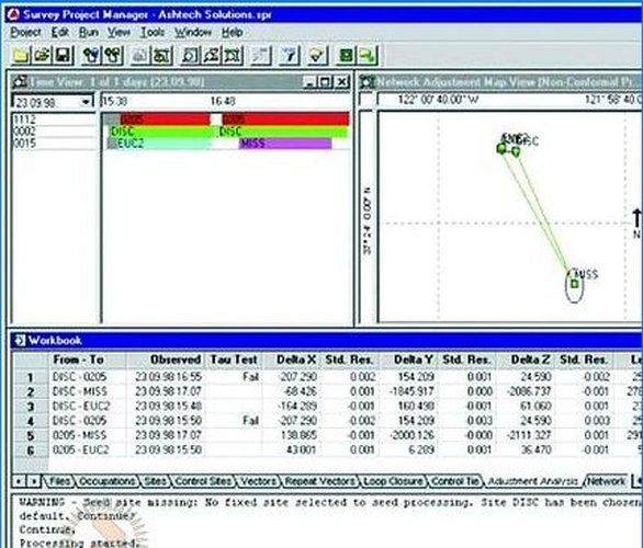
As we can see in the screenshot of one of the data adjustment programs, the green bar is the base operation time, and the short colored bars are the time spent by the receivers at the station with unknown coordinates. Using specialized software, you can reject incorrect measurement values and increase the overall accuracy of the obtained values.
The advantage of this method is the high measurement accuracy, the minus is the time spent on initializing each point.
Kinematics
The “base” is located in the same way at a point with known coordinates, and the second receiver, after initialization, can register points in motion without additional initialization before each measurement. If in the first method we get, suppose, two base points from which the tacheometric survey will be carried out, i.e. for work we still need to have a total station, then in the case of kinematic measurements, two receivers are enough, one of which performs the function of a total station, the point registration time is 1–2 minutes.
This method is well suited for surveying linearly extended objects such as power lines, canals, roads, oil pipelines, etc. The advantage of this method is saving time, the disadvantage is that it is advisable to carry out measurements at a short distance from the base, about 5-15 km. If the signal from the satellite suddenly disappears, the initialization procedure will have to be repeated, so this method is not always possible to apply in large cities where tall buildings and trees cover the horizon.
RTK GPS
If the first two methods give us the position of a point in the international coordinate system, which then needs to be converted into a regional one, then the RTK method (from the English Real Time Kinematic – kinematics in real time) allows us to obtain the values of the spatial position of points in the coordinate system adopted for our area using only one receiver. No, the base point undoubtedly exists, but in this case the base points are fixed on tall buildings, and together they form a network, akin to a mobile one. Both the receiver and base stations exchange information via the Internet, which allows them to synchronize not only with satellites, but also with each other, bypassing the chain of recalculation and adjustment of coordinates in specialized software.
As you understand, base stations are far from being built by enthusiasts, access to them is paid, but it is more than repaid by the number of man-hours spent. Indeed, if in the case of static measurements, the team consists of at least three people, one of whom is guarding the “base”, and the other two perform surveys using a total station, then only one specialist is enough for RTK measurements. The initialization of such devices occurs almost instantly, after a few minutes the tool is ready to collect data or perform the opposite action – to carry out the stakeout of survey points calculated in advance on a computer, which is necessary, for example, when laying out a plot for construction. This is the technology of the future. In general, no matter how paradoxical it sounds, the next generation of surveyors will be represented by IT specialists, the age of programmable calculators and Bradis tables is irrevocably gone.
GPS vs GLONASS
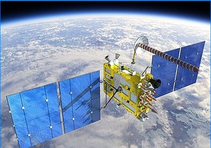
To determine the coordinates of NAVSTAR GPS and GLONASS, 21 active satellites and three spare satellites are used, rotating on circular orbital planes, and these planes in the GPS system are three times more than in GLONASS. The satellites are equipped with solar panels and fly more than 20 km above the Earth’s surface. Such a distance from the planet and the number of satellites provide for the simultaneous observation of at least 4 satellites practically anywhere in the world. Time of a complete revolution around the Earth – 12 cosmic hours.
In the GPS system, all satellites emit a signal at two identical frequencies, and each device sends its own individual code that allows the satellites to be identified. GLONASS has the same code for all satellites, broadcasting is also carried out in two bands. As you can see, the parameters of the systems are about the same, so who is better?
If GPS provides sufficient accuracy in determining coordinates around the world, then GLONASS is “sharpened” for Russian realities, which theoretically allows it to more accurately determine the spatial position of points on the ground in our country. The Russian positioning system does not depend on the mood of “Uncle Sam”, who during military conflicts deliberately lowered the measurement accuracy, partially coding the signal. In any case, GPS and GLONASS are not competitors, but in some way allies, so it makes sense to purchase receivers that simultaneously support two systems, accuracy will only benefit from this..
This text seems intriguing! Can you please elaborate more on the practical applications of applied geodesy in relation to cosmic dimensions? How does geodesy contribute to our understanding of cosmic objects and their measurements?
This article seems interesting, but I’m curious, what practical applications does geodesy have in understanding cosmic dimensions? How does studying geodesy help us gain insights into the vastness of space?
Can you explain how geodesy, specifically applied geodesy, deals with cosmic dimensions? I’m curious to learn about the connection between geodesy and cosmic measurements.